
Reno fire update: New brush fire in Peavine as forward progress of blaze near Sparks stopped- check map

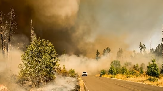
The forward progress of the brushfire in Reno, Nevada, on Tuesday was stopped, the Reno Fire Department confirmed. The fire, which had grown to was dubbed the Barron Fire. But now, the Peavine fire, northwest of Reno, has burned over 100 acres sparking evacuations in the area.
Even though the progress of the fire was stopped, embers continued to burn, with smoke seen in the areas of Reno and Sparks. But to compound the situation in both Reno and Sparks, another brush fire erupted in Peavine, just west of Golden Valley in Washoe County, Nevada.
According to Watch Duty, the fire is now 20 acres and is located south of Red Rock Road at the base of Peavine. The fire is being called “Peavine Fire” by the incident command.
Meanwhile, the blaze south of Sparks near the Reno-Tahoe International Airport was fully under control, the Reno Fire Department said in a statement on social media, jointly with the City of Reno.
“Reno Fire crews are on the scene of a fire near Alexander Lake Road, east of Double R Blvd, near the intersection of Maestro Drive,” the department said. “Forward progress has been stopped, and crews are mopping up. No structures have been damaged.
“Double R Boulevard also remains closed from Double Diamond Parkway to Maestro Drive due to a vehicle accident RPD is working,” the department added, asking people to avoid the area.
Also read: Ben Crump sets up ‘Nolan Wells Tip Line’ to help teen’s family seek answers, ‘If you saw something…’
Peavine Fire Map: Check Areas Affected
The Peavine Fire, though not as close to Reno and Sparks as the earlier fire near the airport, is causing significant smoke in the area. The fire itself is located just south of the Sierra Nevada Zoological Park, off Virginia Street. Since it is a mountainous region with vegetation, no structural threats exist.
Here’s a map of the fire, as seen on Watch Duty.
Peavine Fire Sparks Evacuations
The fire off Peavine Street sparked evacuation warnings in the areas around the Stead Boulevard south of the Sierra Nevada Golf Club. The current evacuation is a Level 3 Set warning, asking residents to be alert for a potential “Go” alert next. The fire is more than 100 acres as of 5pm PDT, according to the National Interagency Fire Center.
Also read: US Iran war: Washington spent $37.5 billion so far in attacks on Iran, Pete Hegseth reveals
Below is a map of the areas under evacuation, shared by Watch Duty reporter, Don Zirbel.
A video shared by a resident on the Facebook page Our City Reno showed that the fire officials are making air drop over the Peavine Fire to bring it under control. So far, it is 0% contained.
This story is being updated.