

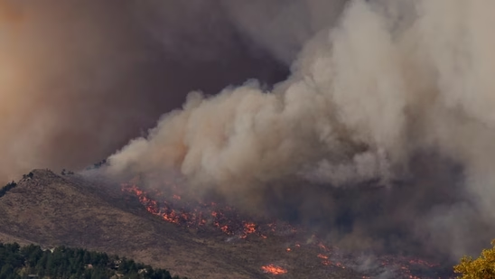
Update: The forward progress of the fire has been stopped, even as some parts that that were already affected continued to burn. The current burn area is estimated at 38 acres.
Original Story: A brush fire on Rainbow Crest, in California’s San Diego County sparked evacuation warning in some areas around Rainbow Crest Rd passing through the heart of the city.
The wildfire is located east of Rainbow Crest, and it is moving further east at a moderate rate of speed, according to Watch Duty, as of 11:35am PDT. Watch Duty says that the fire is now over 50 acres with multiple engines responding. So far, the fire has spread over 50 acres with 0% containment.
Rainbow Fire Evacuations: Check Map, Areas Affected
A Level 3 evacuation warning has been issued for residents further east, though Gomez Creek up to a few miles east of Gomez Creek. A Level 2 Evacuation warning was issued for the areas west of 300 Block of Rainbow Crest. It included areas around Huntley Road, Moonridge Road, and further west till Matt Road.
An evacuation warning was set up Alert San Diego at Seventh Day Adventist Church, on the 1200 block of Old Highway 395 in Fallbrook, San Diego.
Below is a map of the fire and the nearby areas under evacuation. The Red highlight represents Level 3 warning and the Yellow color indicates Level 2 warning.
San Diego Sheriff’s Office Issues Update
The Sheriff’s Office in San Diego issued an advisory for county residents regarding the Thursday’s fire. The residents were asked to “be aware of increased law enforcement and firefighting activity.” Detail regarding the evacuation were also shared by the Sheriff’s Office.
Rainbow is an unincorporated community in the far northern part of San Diego County, just south of the Riverside County line along Interstate 15.