

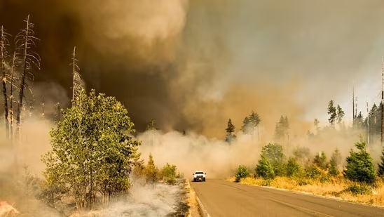
A wildfire broke out in the area of Crestline Trail and Claremont Drive in Boise, Idaho’s Ada County on Monday afternoon. Per Watch Duty, it has spread over 100 acres.
Despite the massive spread of the fire around the Claremont Drive area, no evacuations have been ordered. The fire is moving uphill, burning bushes and vegetation. There is no known threat to structures.
Meanwhile, multiple engines with the Ada County Fire Department are responding to the incident.
Claremont Fire Map: Check Locations Affected By Blaze
Though located just off Route 48 in Ada County, it lies within the grasslands along the Hulls Gluch Reserve, just off Boise Heights. It is located just north of the military reserve forest along the North Mountain Clove Road.
Also read: Will Graham Platner drop out? Stephen King slams Trump as Maine democrat faces assault allegations; ‘Abuser in chief’
Here’s a map on WatchDuty of the fire that erupted Monday.
A Boise, Idaho resident also shared visuals of the incident from Mondat afternoon. Here’s a photo shared by an user on X.
Boise is the capital and largest city of Idaho, located in Ada County in the southwestern part of the state along the Boise River. The city has a population of about 236,000 people, making it Idaho’s most populous city.