


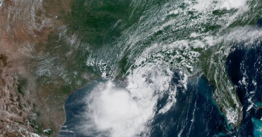
Usually, a storm making landfall in the United States feels like a big deal. But as the center of Tropical Storm Bertha moved over Louisiana on Wednesday, just south of New Orleans, it did so with little fanfare. Here’s what is going on with the storm.
Bertha is lopsided.
The worst of the storm is south of its center, offshore and away from the coastline.
Strong winds out of the north have been pushing the storm off kilter. A named storm like this one needs a calm environment to structure itself into a hurricane, and these winds have not only stunted the intensity of Bertha but have also forced the worst of its potential impacts south of the coastline.
Even the strongest of the tropical-storm-force winds have remained off shore, as the storm made landfall in St. Bernard Parish. Local forecasters in New Orleans weren’t anticipating anything more than a gust of 40 miles per hour. And even those winds were likely to stay contained south of Interstate 10, a major highway that runs along the southern coastline and connects New Orleans and Houston.
Bertha is erratic.
Tropical storms aren’t as well-structured as hurricanes, and they can be a little more erratic and unpredictable.
Over the next day, Bertha’s center is expected to continue to move west, straddling the Louisiana and Texas coastlines, still with the worst likely to remain offshore.
The storm could shift back over the Gulf of Mexico and move toward Houston on Thursday. It could make a second landfall, but it might also never quite emerge back over water, moving inland instead.
Forecasters in Houston don’t seem to be too worried. On Wednesday afternoon, they said that they expected the storm to weaken as it approached because the atmosphere was not hospitable for a strong storm.
Bertha is still a danger.
The storm was given a name for a reason. It met the criteria for a tropical storm, and hurricane hunter aircraft have been flying through the storm and have continually found strong enough winds — stronger than 39 miles per hour — for it to be classified as a named storm.
This has allowed for forecasters to issue vital warnings for impacts that, even in the weakest storms, can still be deadly.
While the winds may not be terribly strong, they can still cause damage. And so can the small storm surge that is possible as the center passes different portions of Louisiana and East Texas this week, especially if the storm surge coincides with high tide.
There is also the possibility of flash flooding in any areas where one of Bertha’s accompanying thunderstorms comes ashore.
The storm is also raising the risk of rip currents along beaches in the southeast. These often-overlooked hazards have been among the deadliest effects of tropical systems near the United States in recent years. They can affect beaches far from a storm’s center, and continue even as blue sky returns.